Inserting Google Earth Maps in Civil 3D
In the article, I will tell you how to Import Google Earth Map Into AutoCAD Civil 3D. We’re going to look at AutoCAD Civil 3d’s Google Earth integration. Frequently Google Earth is used for quick access to aerial photography and services.
The First ting we can do is to adjust the drawing settings by assigning appropriate UTM Zone. Make sure you are already signed in to Autodesk A360.
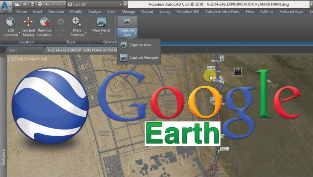
From Geolocation tab go to “Map Aerial”. After a little bit of processing time the google earth image will be shown underneath you drawing layout. You can zoom In Zoom out or Pan to adjust the view.
Now select the “Capture Area” button.
Your Google earth Image will be inserted into your current drawing. This is how you can georeferenced google earth image into Civil 3D.
Thanks to JTCAD, who shared this method in this video. You can learn it here.
Inserting Bing Maps in Civil 3D
While we do not have a direct connection with Google Earth, we do have another option geo-referenced drawing. I can quickly turn on aerial photography.
We have Bing Maps as where the static comes from. We can also capture the area just by making a selection in the drawing. We can pull that image into the file. This image is saved with the picture.
So, we can archive it with our project. We pan around; we can see the quality of the image. At first, it’s a little grainy if we select the image edge. Though We can adjust the condition, we can come up to the ribbon and change the quality to very fine. And you will see the difference. Once again, this image will be saved with the file.
So very easy to access high-quality color aerial photography next we’ll talk about surfaces can start by creating a rectangle that defines our site and then we can export this rectangle as a shapefile. Just a standard GIS shapefile.
We can call it the site boundary. Going through the process here, we can go by selecting the geometry and just creating a quick SHP that defines the extents of our site. When you finished, you can see that the object is exported now.
Infraworks 360 Integration for Map in Civil 3D
Now jump over to the Infraworks 360 programs. You’ve got a tool called “model builder” using model builder. You can select that shapefile boundary and use it to create a model you can see; it identified that location on the earth.
Give your model a name, let’s call it to box culvert replacement. You can then choose the directory where you’d like to save this. You’ll want to create a model now when the new window comes up.
It’ll say it’ll take about you know 5-10 minutes to develop the model depending on the size you’re doing. This is real time now I’m not doing any edits here want
once this data is extracted you will have all the surface information. You can see the models been
this is a relatively quick process now we can we see the estimated time remaining. It goes a lot
faster than that. So, in just a couple seconds, we will have our model on screen.
This is the Infraworks 360 environment. This is where we can do our conceptual design and planning. As you orbit around you can see the surface model that you pulled from the Bing Maps. As well as aerial
photography. Now that you have that surface model, you can pull that into civil3d, just go to the Insert tab you’d like to insert an Infraworks 360 model we just downloaded.
When you select the model next thing you want to do is just come down and refine the selection set as a courtesy. Click OK and open model, and you can see you now have a civil 3d surface.
Go ahead and launch the object viewer. We can orbit this around and take a look at that surface in 3d. When you’re finished reviewing the surface, you can go ahead and close object viewer.
Export Civil 3D Surface to Google Earth
one thing we can do we can export to Google Earth. Just as an example here we can go to go over to the
toolbox. We have an “Export KML” tool. If you launch that you can select either the entire drawing or components from your drawing.
You can then go next through the wizard once the export is finished it will open up in Google Earth. Here you will see your civil3d information in the context of the Google Earth environment.
So right there is your Civil 3D surface inserted into Google Earth. You can pan this around you can zoom in and take a closer look.
As you can see, it’s effortless to export our civil 3d content into the Google Earth environment.
Thanks to Jeff Bartels, who shared this method in this video. You can learn it here.
Convert KMZ Google Earth Data to AutoCAD DWG
Here is a step by step guide to convert Google Earth KMZ Data to AutoCAD drawing and then Export the coordinates from AutoCAD Civil 3D to Microsoft Excel.
- Adjust view and Unit Setting (From Lat/Long to UTM)
- Showing Zone Labels for UTM/Geo Coordinates Identification
- Draw the Marked-up Locations by points lines polygons data in Google Earth
Export Civil 3D Coordinates to Excel
- Save Data in KMZ format.
- Fetch Google Earth Data in Global Mapper Software.
- Convert Google Earth Data (Northing, Easting, Elevation) or Drawing to AutoCAD Civil 3D with Lines and Coordinates (UTM or Lat/Long) by using Global Mapper.
- Adjust the Drawing Setting as per the current UTM Zone in AutoCAD Civil 3D.
- Draw Points with labels in AutoCAD Civil 3D.
- Show/Edit Points Data Table in AutoCAD.
- Export Points (N, E, Z) from AutoCAD Civil 3D to MS Excel.
Related Posts
9 Documents and Data Control Procedures | Record-Keeping Techniques
Download Free Lisp Files For Level Interpolation Slope and Grade